-
 Cambridge (1978)
TPSS with location, date, and listed references Direction : ° Likely W-E
-
 Stevensville (1978)
TPSS with location, date, and listed references Direction : ° Likely W-E
-
 Emsdale (1978)
Noted as part of squall line. (Arctic front) golf ball size hail fell in Huntsville. Direction : 225° (SW-NE), Damage Cost: N/A, likely >$50,000
-
 Cumberland to Glenburn (1978)
The first Ontario portion of the Lac Carmen to Masson, Quebec F3 tornado. No funnel cloud seen, minor damage occurred in this area. Max width listed as likely narrow, Direction : 285° (WNW-ESE)
-
 St. Bernardin to McAlpine (1978)
A powerful and messy storm moving through the area likely produced an F2 rain wrapped tornado. It was responsible for the long track F3 tornado which tracked through western Quebec earlier in the afternoon. No reports of funnel clouds observed, but one woman in St. Amour claimed to have seen trees being uprooted and carried aloft during the storm. Direction : 223° (SW-NE)
-
 Dillon (1978)
Very possible a tornado tracked through the area early morning. Golf ball hail was reported in Huntsville as the storm progressed eastward. Report of the storm system in EC file. Damage Cost: N/A, likely <$5,000
-
 Dromore (1978)
TPSS with location, time, and references listed.
-
 Hillsburgh (1978)
Noted as sounding like “10 freight trains†as it passed over. A few farms were hit but mostly minimal damage occurred. Track Length : UTM = 5.34km (3.32mi) report = 2.5km (1.5mi) *likely skipped along latter half – see track map, Direction : UTM = 260° (W-E) report = WSW-ENE, Damage Cost:“Thousandsâ€
-
 Baptiste (1978)
TPSS with location, time, damage and references indicated. Direction : N/A° noted as W-E
-
 Dickey Lake (1978)
Winds “sounding like a freight train†Check listed references for details.
-
 Niagara-on-the-Lake (1978)
Winds up to 60mph recorded at St. Catharines Airfield. See listed references for details. Direction : N/A° noted as W-E, Shape : N/A - noted that workers saw storm coming
-
 Winchester (1978)
TPSS with general location, date, and listed references.
-
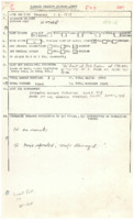 Winthrop (1978)
TPSS with location, date, and listed references.
-
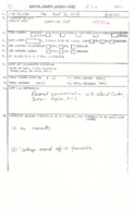 Carling Bay (1978)
TPSS with location, time, and reports attached. Possible tornado as a cottage was moved 6ft off its foundation. Direction : N/A° likely SSW-NNE, Damage cost: N/A, likely <$5,000
-
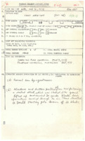 Appleton (1978)
Funnel was seen by eyewitnesses. Mostly minor damage but seems to have been a strong F0. See newspapers for more info. Direction : approx. 225° (SW-NE), Damage Cost: N/A, likely <$5,000
-
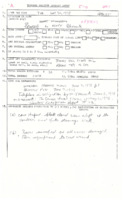 Brussels to Bluevale (1978)
Particularly severe thunderstorm produced an F0 tornado beween Brussels and Bluevale. Witnesses observed a black cone shaped funnel an a few farms suffered damage from it. Hail up to the size of tennis balls was reported with the storm and farmers heard a loud roar. Track Length : UTM = 5.8km (3.6mi) report = 3km / 2mi, Direction : UTM = 179° (S-N) report = SW-NE, Damage Cost: N/A, likely $10,000s
-
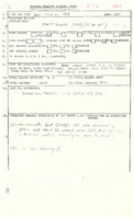 Salem (1978)
Tornado was said to have lasted several minutes and plucked a car’s hood off. OPP received call about tornado moving west to east. Track Length : <1mile, Direction : 245° (WSW-ENE), Damage Cost: N/A, likely <$1,000
-
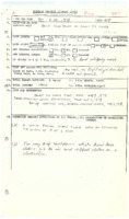 Sault Ste. Marie (1978)
Witness observed two very brief touchdowns. No rain, lightning, or thunder. Noted as a cold air funnel. Track Length : <1mile, Direction : 000° (N-S) (approx.)
-
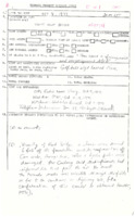 Kent Bridge (1977)
Witness said “then came a funny noise and everything went black†as tornado struck. Golf ball sized hail was reported in Essex. Second hand report stated that tornado track was visible as far away as SW of highway 40. (18km) Track Length : UTM = 4.74km (2.95mi) possibly up to 18km. Direction : UTM = 252° (WSW-ENE), Damage Cost: N/A, likely >$100,000
-
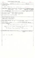 Tiverton to Underwood (1977)
Strong F1 or F2? A very close call for one family in particular who was only feet away from having their farmhouse completely destroyed. Direction : UTM = 219° (SW-NE); Damage Cost: likely >$100,000
-
 Goderich (1977)
A witness (likely weather station officer) observed and photographed a funnel cloud over the Goderich area. Noted that it was ¾ of the way to the surface and the bottom was obscured by the tree line. Cold air funnel?
-
 Mississauga (1977)
A rare early morning tornado. One witness claimed to have seen a dark funnel just before trees started coming down. Another woman saw a porch fly through the air and heard the tornado approaching. She also claimed to have seen the tornado. Time : 5:30AM or 6:30AM, Direction : UTM = 281° (W-E), Damage Cost: Reports of $1M - $3M
-
 Copetown (1977)
Sky became yellow. Believed to be isolated incident. Storm (supercell) responsible produced F2 tornadoes before and after this damage. Likely brief spin-up. Track Length : N/A, brief, Direction : N/A° likely around 280° (W-E), Damage Cost: N/A, likely $10,000’s
-
 Mary Lake (1977)
Observed for 20-25mins by one individual moving slowly for about 2 miles. One witness observed it moving fast over Lake Vernon, near where it was said to have formed over land. He observed it for about 30mins. Sounded like a train. No thunderstorm observed. Located on back end of CB from a shelf of cloud. (strong cold core funnel?) Time : 3:05PM notes = early evening (4-5PM), Track Length : Possibly 8km (5mi) (likely greater if actually over both Lake Vernon and Mary Lake)
-
 Beamsville (1977)
Tornado observed by many witnesses in the area. One farming family was out working a field when the storm came up and they decided to head for the house. Minutes later they observed the tornado touch down in their field and watched it begin its track towards the east. Other locals also saw the tornado from short distances. One family watched the tornado for their front door weave back and forth carrying away everything in its path. Another family sheltered in their farmhouse as the tornado struck, badly damaging the house and wrecking their barn. Many large chicken and pig barns along the track were completely collapsed. Near the end of the tornado’s track, golfers at 20 mile golf course witnessed the tornado spin through the immediate area, toppling trees and flattening corn fields. Shortly after, the tornado roped out. Radar echo tops indicated in the area were about 12.8km (42,000ft) at the time. The storm responsible tracked from the Plattsville area, over 100km away, and produced another F2 tornado in Ayr, indicating it was a cyclic supercell. Direction : 267° (W-E), Deaths: 0 (5500 chicks)

