-
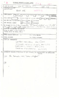 Plattsville to Ayr (1977)
EC file seems to be missing much information. Check into. TPSS with general location, time, and listed references. Check for details. Significant tornado and storm produced another F2 in Niagara and possibly a brief F0 in Copetown. Direction : 280°? (W-E)
-
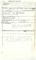 Loretto (1977)
No funnel mentioned, but a narrow path of damage indicated “spiral stormâ€, therefore probable. Uncommon NNW-SSE track. Direction : UTM = 018° (NNE-SSW) (S-shaped track), Damage Cost: “Little†damage. ($<5,000?)
-
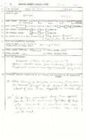 Drayton (1977)
A local witness observed a cone-shaped tornado from about 4-5 miles away, for about 1 minute. It was moving approximately 50-60mph west to east, and was tilted at a 45° angle. Damage seems high for F0 rating (store unroofed = F1?) Direction : 274° (W-E), Damage Cost: Likely >$10,000
-
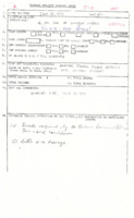 Rivière–aux–Canard (1977)
Brief funnel cloud touchdown as reported by OPP and referenced to EC. No damage reported. Linear storm system moving NW-SE. Track length: N/A, brief, Direction : N/A° likely NW-SE (storm motion)
-
 Wardsville (1977)
Changed from Probable to Possible due to lack of damage evidence. Possible tornado reported by pilot over Lake Erie.
-
 Holland River to Sharon (1977)
A rare early morning tornado. One witness claimed to have seen a dark funnel just before trees started coming down. Another woman saw a porch fly through the air and heard the tornado approaching. She also claimed to have seen the tornado. Direction : UTM = 306° (NW-SE), Damage Cost: N/A, likely >$250,000
-
 Churchville to Queensville (1977)
Radar tops 18.3km (60,000ft). Tornado embedded in derecho. Golf ball size hail in Innisfil. Yellowish-orange clouds. Witnesses observed the tornado with apparent satellite vortex bobbing up and down to the side of parent vortex. Noted that a “plow wind†1mi wide was suspected from Cook Bay and south. Noted that it was miraculous that no one was hurt. *Sat. June 9, 1906 tornado in same area?* Witness noted that three other tornadoes occurred within the same decade around the Queensville area, and another one was mentioned to have occurred in 1964, 1 mi east of this tornado track. Track Length : UTM = 23.26km (14.45mi) Update sheet = 1.52km (0.94mi), Max Width : 50m (164ft) notes indicate about 200ft wide, Direction : UTM = 305° (NW-SE) Confirmation sheet = 290° (WNW-ESE), Damage Cost: N/A, likely >$10,000
-
 Ottawa (1977)
TPSS with general location and time. NO references or F-rating, but confirmed
-
 Cloud Bay (1977)
TPSS with location, and time. No references listed
-
 Windsor (1977)
A funnel cloud was spotted earlier in Michigan. A witness saw a large black cone-shaped cloud travelling along the ground and towards their house. It struck the property and produced considerable damage. Time : 2:30PM or 3:00PM, Direction : UTM = 332° (NNW-SSE); likely >$15,000
-
 Cottam & Albuna (1977)
No funnel mentioned, but a narrow path of damage indicated “spiral stormâ€, therefore probable. Uncommon NNW-SSE track. Track Length : <1mile, Direction : N/A° W-E?
-
 Staples (1977)
No funnel mentioned, but a narrow path of damage indicated “spiral stormâ€, therefore probable. Uncommon NNW-SSE track. Track Length : <1mile, Direction : ° likely SW-NE or W-E as storm motion mentioned in wx reports
-
 Amherstburg (1977)
Funnel cloud observed over *Exeter*, (*typo – Essex?) accompanied by pea sized hail. Minor damage and swirling seen in fields near Amherstburg indicating tornado touchdown. Track Length : N/A possibly 24km (15mi), Direction : N/A° possibly WSW-ENE
-
 Havelock (1976)
TPSS with location, time, and damage indicated. Notes indicate man heard a roaring sound. Damage Cost: likely : "very little" $1,000s
-
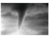 Point Pelee (1976)
Two photos of a funnel cloud observed over Point Pelee.
-
 Sarnia (1976)
Brief touchdown witnessed at Sarnia Airfield. Track Length : <1mile
-
 Collins Bay (1976)
A white whirling “thing†was observed with a loud hissing sound. Damage area less than 1km. Confirmed brief tornado. Direction : UTM = 250° (WSW-ENE)
-
 North York & Thornhill (1976)
Tornado accompanied by 3†hail. See referenced newspapers for details. Track Length : <1mile, Max Width : ¼ to ½ block, Direction : Approx. 180° (S-N)
-
 Benoir Lake (1976)
Rare early morning tornado struck Pine Grove Point Tourist Camp north of Harcourt. Radar indicated storm track of NW to SE. Aerial survey from hydro company revealed pockets of damage where the forest was laid waste. No official measurements for track but likely a brief touchdown. Direction : Approx. 315° (NW-SE)
-
 Georgetown (1976)
Unusual mostly N-S tracking tornado and relatively low topped storm cell of only 8km (26,000ft). Tornado witnessed by several people in Georgetown, one of which was a trained weather observer. A number of exposed individuals were knocked over or thrown, with only 2 injuries reported. Time : 3:30PM (could be 3:15), Direction : 341° (NNW-SSE)
-
 Exeter (1976)
“Nothing knownâ€
-
 Ottawa Airport (1976)
“Funnel seen by ATC at Ottawa Airport. It crossed the river and picked up water, closer than 1.5 miles from control tower stirred trees near the end of runway 07.†Little to no sound. Track Length : TPSS<1mile, possibly 3km (1.86mi), Direction : Approx. 225° (SW-NE)
-
 Forest to Parkhill (1976)
Direction : 261° (W-E), Damage Cost: N/A, likely >$10,000
-
 Hagersville (1976)
TPSS with general location, approximate time and date, damage indicated, and listed references. Time listed as afternoon
-
 Kirkfield to Cameron (1976)
A woman witnessed a long black funnel take aim for her farm from the west. A roaring sound was heard with it. Notes say an individual thought the tornado went down toward Cameron. Direction : UTM = 306° (NW-SE), Damage Cost: N/A, likely $10,000s

