-
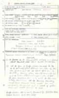 Chesterville to Sandtown (1973)
A strong tornado touched down in Chesterville in the early evening of June 11 and tracked ESE for the first half and ENE for the second half of its way toward Sandtown where it lifted. About 10 properties sustained damage. See newspapers for details. Max Width : N/A – swath cut in bush, Direction : UTM = 270° (W-E), Injuries and deaths both 0 (injuries and deaths to calves), Damage cost:N/A, likely >$100,000
-
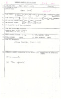 North Gower (1973)
TPSS with location, approximate time, date, and listed references Time listed as evening
-
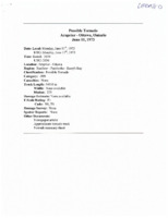 Arnprior to Ottawa (1973)
Possible long tracking tornado spawned by a particularly severe storm which travelled over 250km along the Ottawa River Valley from at least Mattawa to Ottawa. Golf ball hail, frequent lightning, and severe winds and rain were also recorded with the storm. Direction : 275° (W-E), Shape : N/A, however a motorist driving on the heels of the storm between Mattawa and Pembroke stated that “it was like driving through the base of Niagara Fallsâ€, Damage Cost: N/A, likely >$50,000
-
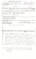 Pembroke (1973)
Witnesses on the shore of the Ottawa River just north of Pembroke saw waterspouts become one, it made landfall at Pembroke damaging trees, buildings and other property. Hail fell just after the tornado. See newspaper for further reading. Time listed as between 3:00 – 3:30PM, Approx. 3km (1.86mi) over land – total length likely 6+km, Direction : Approx. 300° (WNW-ESE), Damage Cost: N/A, likely >$50,000
-
 Pine Grove (1972)
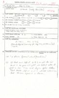
A tornado touched down in the evening in the Pine Grove area of Ottawa. Sadly, a 14 year old girl was killed as the tornado picked up a shed and it landed on her. Other minor damage was reported in the area and possibly Quebec. Time listed as N/A newspaper = 19:30, Damage Cost: N/A, likely <$5,000
-
 Dickson Lake (Algonquin Provincial Park) (1972)
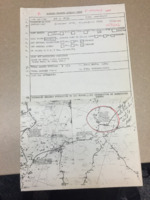
On park map: “On July 22, 1972 a tornado cut a 15 mile-long swath which smashed across this portage. Such spectacular natural disturbances are rare in Algonquin.†Probable strong tornado due to length of swath cut through woods. Noted to cut across portage P1230 (now P1100) Direction : N/A° estimated roughly W-E
-
 Ottawa (1972)
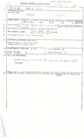
TPSS with general location and date, unconfirmed report of brief tornado touchdown. See climatological report. More info needed.
-
 Inwood to Glencoe to Dutton (1972)
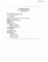
An early morning and early season strong tornado. A few witnesses claimed to have seen the early morning tornado and said it was a fast moving funnel-like cloud with a terrible roaring noise. One man just north of Glencoe was likely spared his life by inches when a metal pole flew from his barn into his bedroom and impaled the mattress he was asleep on. Track Length : UTM = 37.34km (23.2mi) Re-assessment = 26.05km (16.19mi), Direction : 290° (WNW-ESE), Deaths: 0 (10 pigs, 2 cattle), Damage Cost:Likely >$250,000
-
 St. Albert to Casselman (1971)
Tornado discovered in 2001 through research assistant Brad Rousseau. In communication with Etienne Grégoire, [CIS-RCNC] who had moved to the area around the time, it was revealed that an obvious tornadic damage track was evident in the area. Newspapers should still be checked to see if this tornado was an oversight of Mike Newark’s research. Max Width : N/A, narrow damage path, Direction : 205° (SSW-NNE); likely >$250,000
-
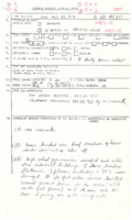 Wees Beach - Sarnia (1971)
Probable touchdown in the Wees Beach neighborhood of Sarnia. Light damage. Trees knocked over in Retlaw Park and by Indian Rd. Track Length : N/A, likely about 250m (820ft) (may have skipped along), Direction : N/A° likely SW-NE; likely <$5,000
-
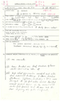 Sarnia to Brights Grove (1971)
Tornado touched down in SE Sarnia and tracked through a mixed zoning of residential, commercial, and green space. The Windsor Airport was also hit and planes were damaged. After striking Brights Grove, it headed over Lake Huron and threw a boat (source) before dissipating. Direction : 234° (SW-NE), Shape : N/A, rain-wrapped, “rained extremely hard, sky turned a dirty brown colorâ€, There were 10 other injuries in Port Huron, MI; cost: likely >$250,000
-
 Sparta (1971)
http://inmagic.elgin-county.on.ca/ask/results.aspx?AC=GET_RECORD&XC=/ask/results.aspx&BU=http%3A%2F%2Finmagic.elgin-county.on.ca%2Fask%2F&GI=&TN=Descr&SN=AUTO9037&SE=1168&RN=0&MR=10&TR=0&TX=1000&ES=0&XP=&RF=WebRelevance2013&EF=&DF=WebFull2013&RL=0&EL=0&DL=0&NP=255&ID=&MF=GENERICENGWPMSG.INI&DT=&ST=0&IR=115162&NR=0&NB=1&SV=0&SS=0&BG=&FG=&QS= Time listed as Night
-
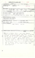 Oakville (1971)
Spawned by a potent squall line which affected Southern and Central Ontario. Tornado touched down and struck a farm located on Dundas Street just southwest of Trafalgar in Oakville. The farm owner watched the tornado come over the farm and when it had cleared his barn lay in ruins. This would warrant at least an F1 rating unless the barn was old, weak, or poorly built. Possibly needs upgrading. Track length listed as <1mile, Direction : N/A° likely W-E, Damage Cost: N/A, likely around $18,000
-
 Sarnia (1971)
Possible tornado produced from squall line affecting most of Southern Ontario. Due to damage noted in newspaper, this tornado would have produced F2 damage as 3 houses had their roofs torn off. Warrants some investigating. Direction : N/A°, likely W-E
-
 McGregor (1971)
Heavy wind, rain, and hailstorm noted. Witnesses saw the tornado touch down and approach the area and noted that it had an unusual shape. Noted that there was no sounds from it to warn them of danger. The trailer park which was hit by the tornado was also struck by a severe storm one year earlier. Direction : UTM = 231° (SW-NE), Damage Cost: “$ thousands†likely >$50,000
-
 Atwood & West Monkton (1971)
Tornado touched down near the hamlet of Henfryn alongside Newry Rd. and tracked ESE parallel to the road for approximately 13km causing major damage to a number of farms. At one point it plowed through a bush lot which observers afterward said looked like it had been “shelledâ€. Should be upgraded to F2 rating as barns were destroyed with their debris scattered. Direction : 300° (WNW-ESE), Shape : N/A, “called a tornadoâ€, Damage Cost: N/A, likely >$50,000
-
 Sarnia (1971)
Sarnia weather office person observed three funnels over the Sarnia Airport. Minor damage reported. Time : Approx. 1:00PM, Direction : N/A° SW-NE
-
 Bayfield to Fordwich (1970)
A long track and damaging tornado. A damage path was reported from as far SW as the shore of Lake Huron south of Bayfield, and NE to the Fordwich area, tracking almost 70km through Huron County. See the Listowel Banner for a detailed description and local accounts of the storm. Direction : 235° (SW-NE), Deaths : 0 (2 cows, 12,000 chicks), Damage Cost: N/A, likely >$100,000
-
 Eganville (1970)
TPSS with location, general time, and damage indicated in a newspaper. Damage path over a two block area of Eganville. Time listed as evening, track length listed as <1mile
-
 Orangeville to Caledon (1970)
Noted as the worst storm to hit the Caledon area by long time residents. First of two F2 tornadoes produced by an intense supercell which developed SW of Mount Forest in the late afternoon of the 30th. Barn roof debris was noted to have been airborne for 22mi (kilometers; metrication began in Canada 1970) originating from Fergus Rd. and landing in the Caledon Fairgrounds. Max Width : N/A, 4.57m (15ft) on TPSS, Direction : 285° (WNW-ESE), Damage Cost: N/A, likely around $100,000
-
 Toronto International Airport (1970)
A strong thunderstorm complex exploded upwards in Midwestern Ontario just SE of Mount Forest in the late afternoon of the 30th. At the weather office in Toronto, overshooting tops above 50,000ft were observed to the NW indicating supercell development. The storms intensified and tracked southeast for approximately 80km at which a tornado touched down just west of the entry of runway 23 at Toronto International Airport (LBC?) and tracked ESE over commercial and residential areas. This was one of two F2 tornados produced by the storm. The first touched down west of Orangeville. Note: A round of thunderstorms on the morning of the 30th produced lightning which killed a worker on the tarmac of the airport. Time : 6:00PM (shortly after 6:45PM in report?), Direction : 284° (WNW-ESE), Injuries : Some minor injuries? (None serious)
-
 Batty Lake to Savage Lake (1970)
Portion of damage track investigated by Gee and Findlay (see AES report) in the Elliot Lake to Western Sudbury County area. Noted that 80-90% of the trees in the damage track north of Massey were flattened. No evidence of damage was observed directly west of Batty Lake or East of Savage Lake, therefore identified as a separate tornado as opposed to the idea that a single tornado tracked from east of Sault Ste. Marie to the Quebec border. Time is a rough estimate. Direction : 275° (W-E)
-
 Elliot Lake to Temiscaming (1970)
-
 Field (1970)
Part of original (and incorrect) 280km damage track. Storm likely occurred shortly after 9AM and caused significant to devastating damage to most of the small town. Unconfirmed reports stated that half of the 600 houses in field were left damaged beyond repair, leaving about 400 people homeless. Direction : 250° (WSW-ENE)
-
 Lively to Sudbury (1970)
The eighth deadliest tornado in Canadian history and fourth in Ontario. Very strong tornado spawned by particularly intense storm as part of a squall/derecho event. A number of witnesses saw the storm and tornado approaching. Some houses were destroyed down to their foundations. This is likely F4 type damage although was not confirmed by EC. (report by Dave Sills?) Most of the deaths were attributed to vehicles interacting with tornadic winds. Direction : 250° (WSW-ENE), Injuries and Deaths both listed as needing clarifying, Damage Cost: $17M (estimated and possibly 20XX $?)

