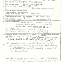
Sebringville (1970)
Item
-
Title
-
Sebringville (1970)
-
Description
-
An intermittent path of damage almost 14km long was found south of the Sebringville area after a tornado was observed skipping through the bush. Unknown condition of barns which lost their roofs – likely strong F0 or possibly an F1? Track Length : UTM = 13.5km (8.39mi) TPSS = 14km (8.7km) (intermittent damage), Direction : 251° (WSW-ENE); Damage Cost: likely >$10,000
-
Publisher
-
NTP Archives
-
Date
-
1970-05-26
-
Time (Local)
-
17:30
-
County
-
Perth
-
Province
-
Ontario
-
Country
-
Canada
-
Fujita Rating
-
F0
-
Classification
-
Confirmed
-
Track Length
-
13.5
-
Direction
-
WSW - ENE
-
Shape
-
Funnel cloud skipping along
-
Damage Type
-
Barns were unroofed, a brick chimney was felled and damaged a roof, trees uprooted, one fell across a tractor.