Atwood & West Monkton (1971)
Item
-
Title
-
Atwood & West Monkton (1971)
-
Description
-
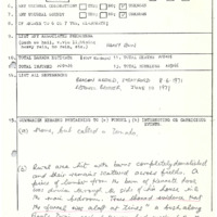
Tornado touched down near the hamlet of Henfryn alongside Newry Rd. and tracked ESE parallel to the road for approximately 13km causing major damage to a number of farms. At one point it plowed through a bush lot which observers afterward said looked like it had been “shelledâ€. Should be upgraded to F2 rating as barns were destroyed with their debris scattered. Direction : 300° (WNW-ESE), Shape : N/A, “called a tornadoâ€, Damage Cost: N/A, likely >$50,000
-
Publisher
-
NTP Archives
-
Date
-
1971-06-08
-
Time (Local)
-
18:20
-
County
-
Perth
-
Province
-
Ontario
-
Country
-
Canada
-
Fujita Rating
-
F1
-
Classification
-
Probable
-
Track Length
-
1.97
-
Direction
-
WNW - ESE
-
Damage Type
-
A barn and drive shed were demolished, a 250gal gas tank was thrown on a children’s playset, destroying it, a verandah was demolished and the top of a silo was blown off.