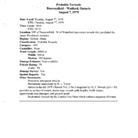
Beaconsfield to Waterford (1979)
Item
-
Title
-
Beaconsfield to Waterford (1979)
-
Description
-
The probable satellite tornado of the Woodstock to Waterford tornado. A number of documented witness accounts exist which indicate a second smaller and weaker tornado accompanied the large parent vortex along western periphery of its path. Track Length : Approx. 30km (18.64mi) (estimated), Max Width : 900m (2953ft) source? seems wrong (max 600m?), Direction : 300° (WNW-ESE)
-
Publisher
-
NTP Archives
-
Date
-
1979-08-08
-
Time (Local)
-
19:10
-
County
-
Oxford-Norfolk
-
Province
-
Ontario
-
Country
-
Canada
-
Fujita Rating
-
F0
-
Classification
-
Probable
-
Track Length
-
30
-
Max Width
-
0.9
-
Direction
-
WNW - ESE
-
Damage Type
-
Swath of trees downed