Lyndhurst (Lower Beverley Lake) (1979)
Item
-
Title
-
Lyndhurst (Lower Beverley Lake) (1979)
-
Description
-
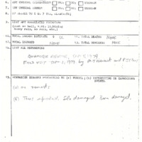
Probable tornado responsible for path of damage beginning along Halladay Bay on Lower Beverley Lake, heading east and hitting a farm on Highway 42, and tracking along the south side of 42 in a NE direction snapping some trees along the way. Direction : 259° (W-E), Damage Cost: N/A likely >$5,000
-
Publisher
-
NTP Archives
-
Date
-
1979-08-30
-
Time (Local)
-
14:25
-
County
-
Leeds & Grenville
-
Province
-
Ontario
-
Country
-
Canada
-
Fujita Rating
-
F0
-
Classification
-
Probable
-
Track Length
-
2.6
-
Max Width
-
0.18
-
Direction
-
W - E
-
Damage Type
-
A barn and silo were damaged. Other minor property damage occurred. Trees damaged or uprooted.